
Tornado warning issued for Sumter, Clarendon, plus more weather updates for Hurricane Sally remnants effects


2 p.m., Sept. 17
There are reports starting to come in of water reaching the doors of some homes and buildings along Alice Drive/Wise Drive and Calhoun downtown.
---
1:10: p.m., Sept. 17
After a brief respite, most of Sumter County is back under a tornado warning, this time until 2 p.m.
At 1:11 p.m., a severe thunderstorm capable of producing a tornado was located near Poinsett State Park, and NWS radar has indicated rotation.
The storm will be near the park around 1:20 p.m., near Sumter, south Sumter, Shaw Air Force Base, Millwood and Oakland around 1:45 p.m. It will be near Mulberry around 1:50 p.m. and near the airport around 1:55 p.m.
Other locations impacted by this tornadic thunderstorm include Wedgewood, Cane Savannah, Oswego, Dalzell, East Sumter, Pinewood, Cherryvale, Lakewood, Privateer and Stateburg.
---
Noon, Sept. 17
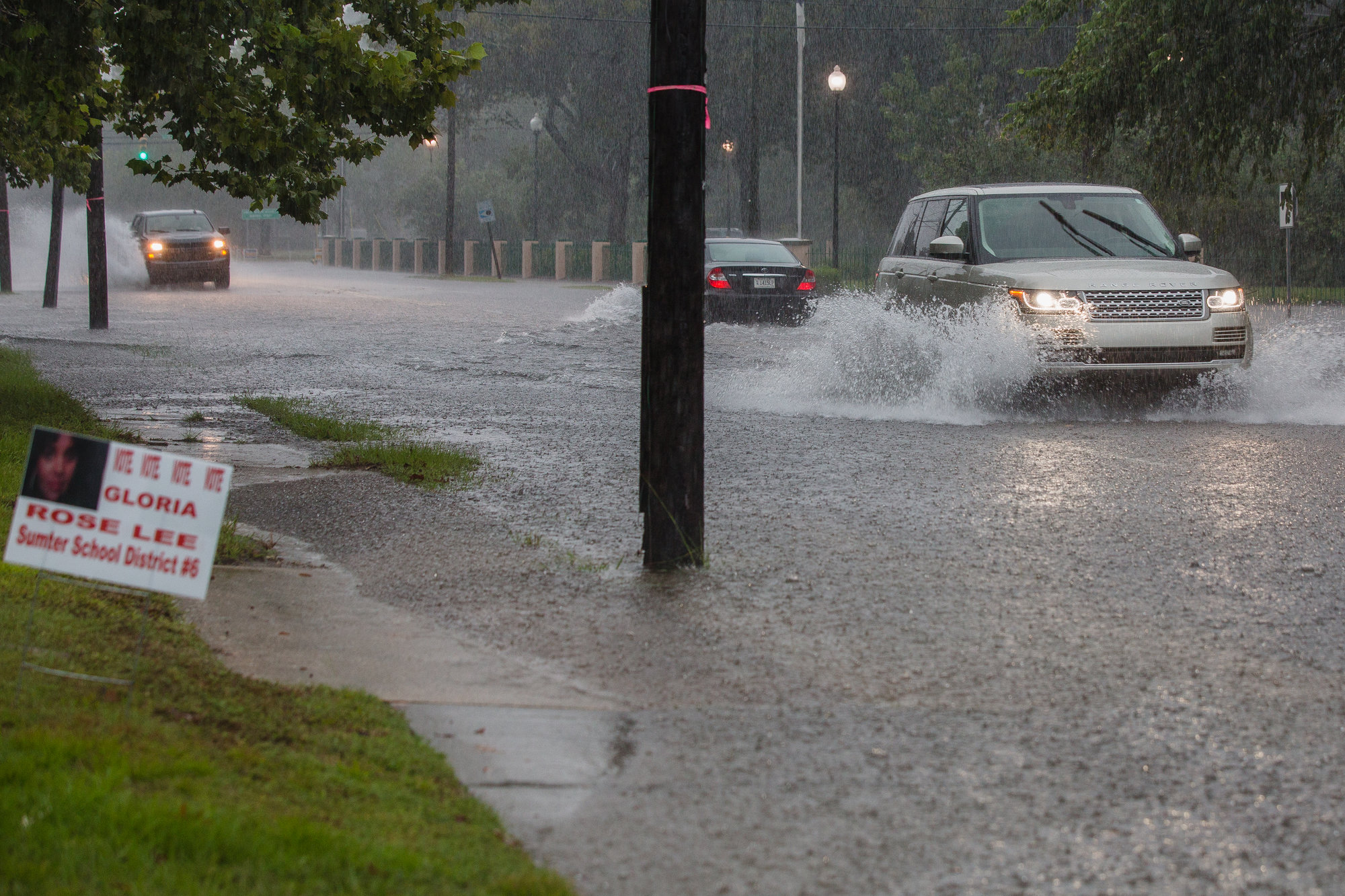
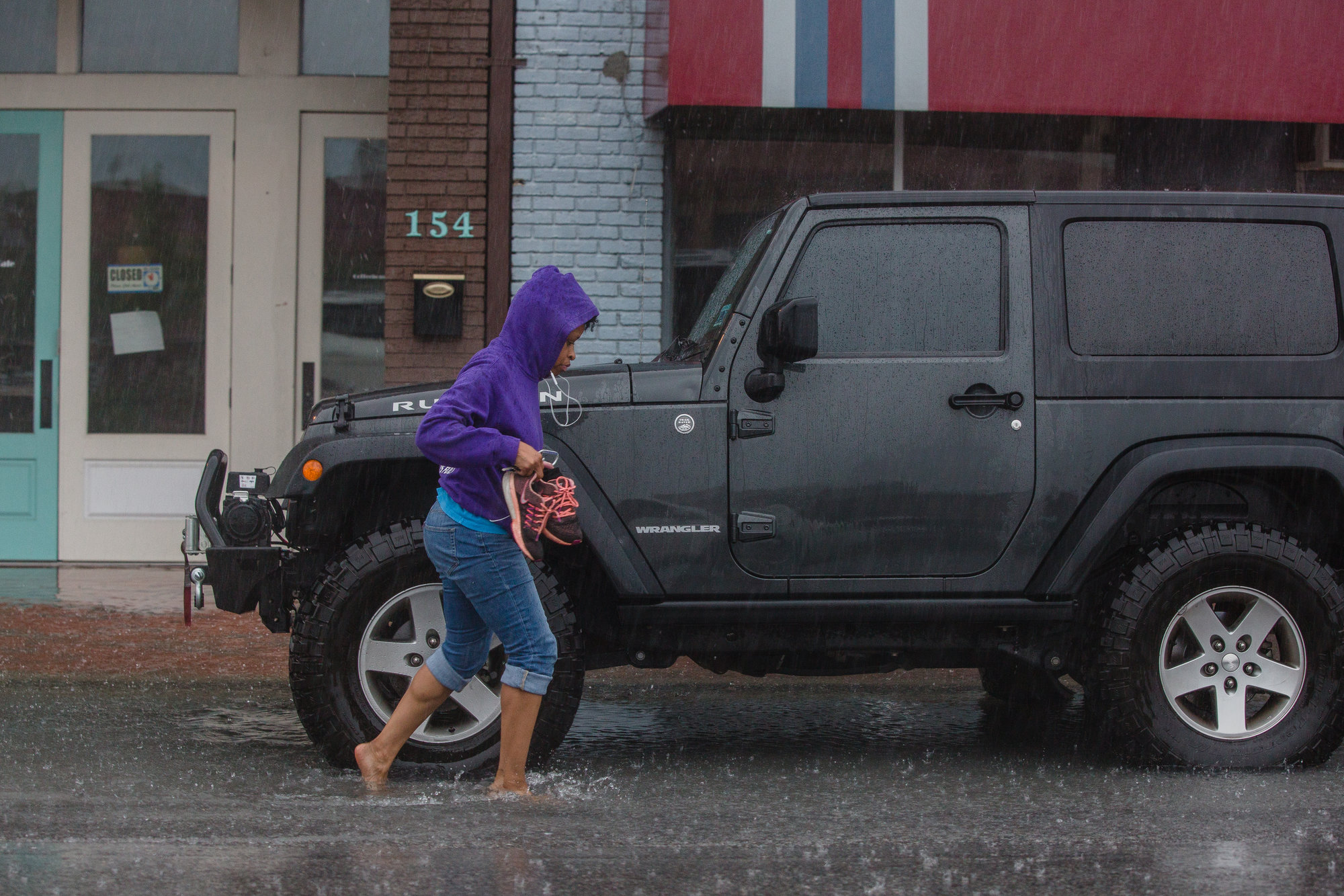
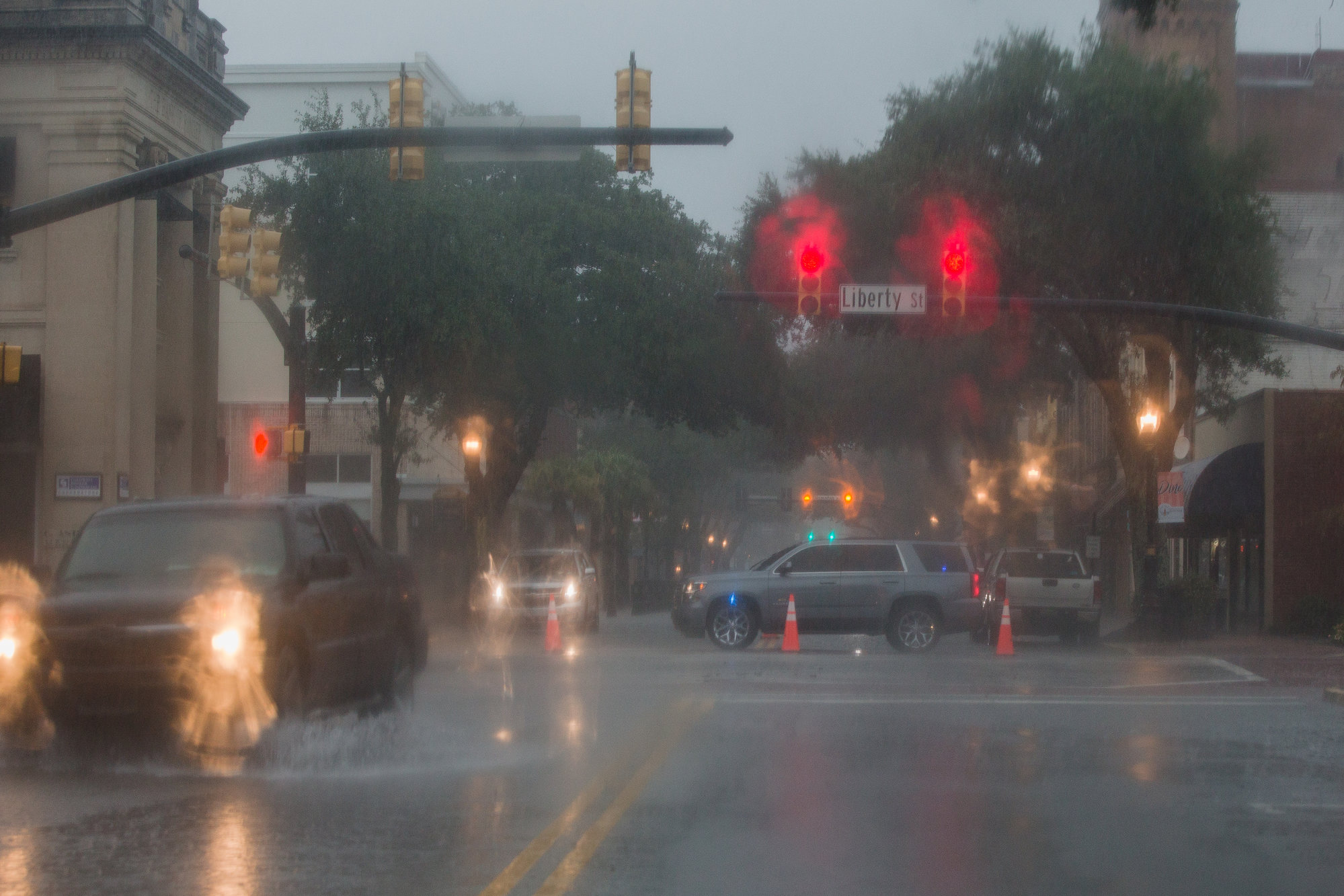
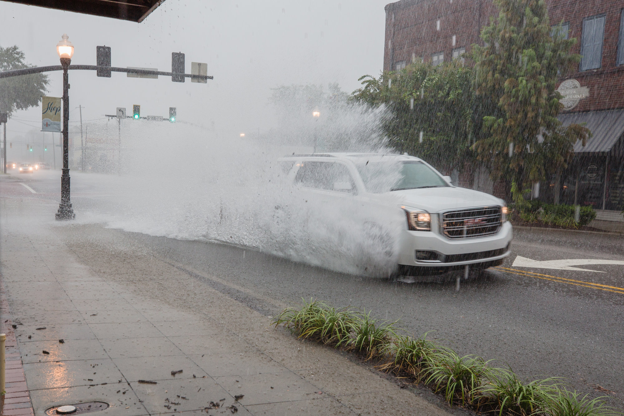
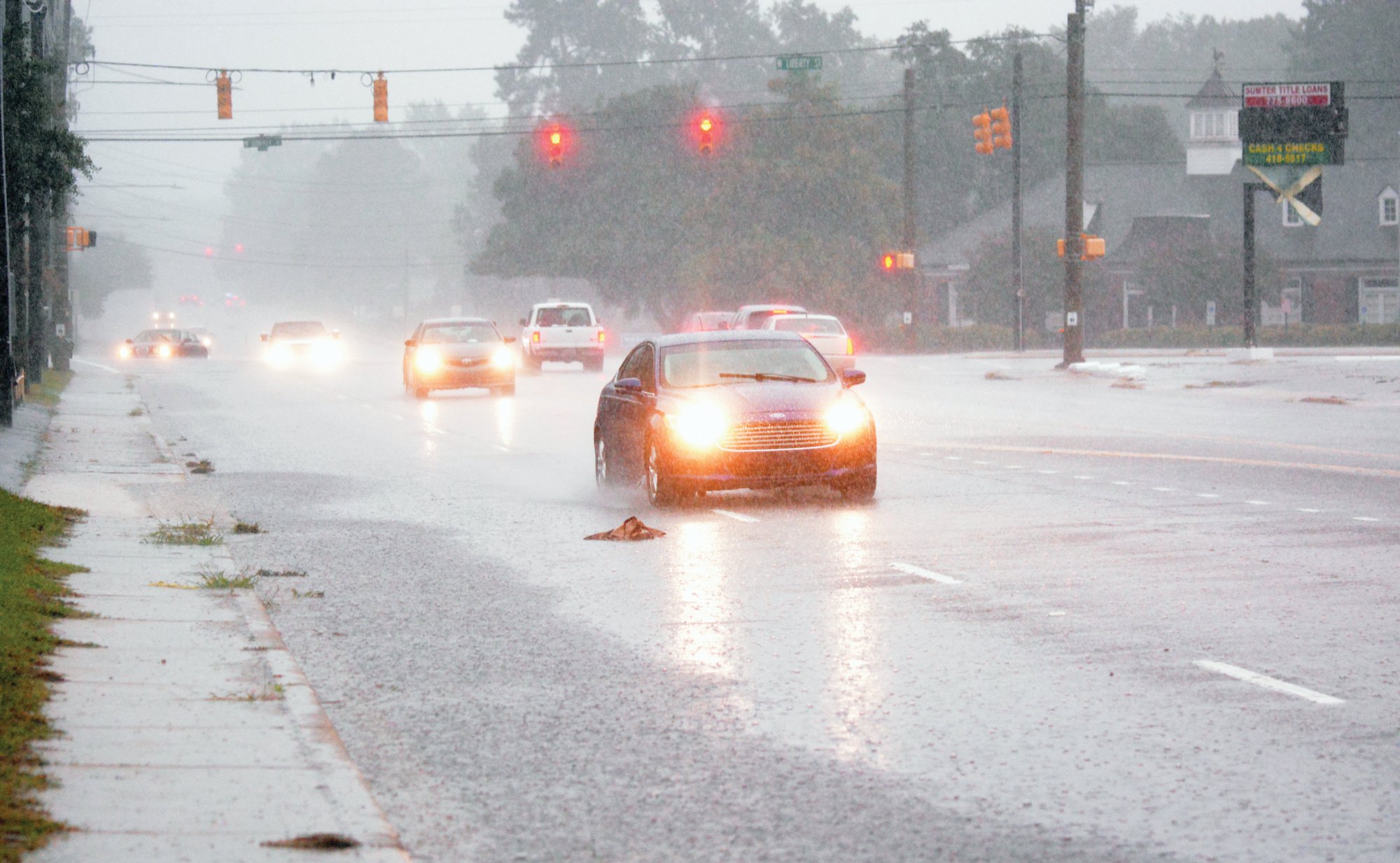
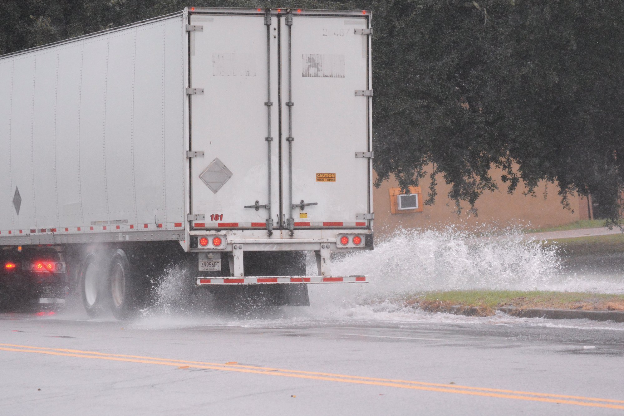
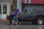
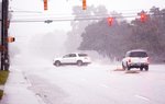
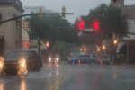
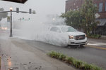
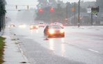
Do not drive right now if you don't have to. Roads are flooding all over the city.
We've heard reports of cars getting stalled at the Guignard Drive/Liberty Street intersection and getting flooded at Lafayette Street/Calhoun. Most of Main Street downtown is blocked off. A car has stalled in the water at Broad Street/Church Street.
Even a small amount of water in the road can stall your vehicle.
---
11:30 a.m., Sept. 17
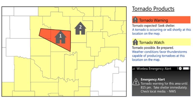
A third alert has extended the tornado warning until 12:15 p.m. and now applies to southern Lee County and much of Sumter County in the city and to the south, east and north.
At 11:27 a.m., a severe thunderstorm capable of producing a tornado was located near south Sumter, moving north at 25 miles per hour.
The storm will be near Sumter around 11:35 a.m., south Sumter and Millwood around 11:40 a.m., Mulberry around 11:45 a.m. and the Sumter airport around 11:50 a.m.
Other locations impacted include Oswego, East Sumter, St. Charles, Mayesville, Brogdon, Lakewood, Lynchburg and Dalzell.
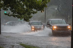
Reports of flooded roadways are continuing to come in, especially along city streets.
---
11:15 a.m., Sept. 17
A second tornado warning of the morning has been issued for southwestern Sumter County.
This warning is in effect until 11:30 a.m., according to the National Weather Service, and also applies to central Clarendon County.
A severe thunderstorm capable of producing a tornado was located near Summerton around 10:44 a.m., with radar indicating rotation. The storm will be near Poinsett State Park around 11:20 a.m. and near Sumter and Millwood around 11:30 a.m.
Other locations impacted by this “tornadic thunderstorm” include Wedgewood, Cane Savannah, Pinewood, Rimini, Paxville, Lakewood, Privateer and east Sumter.
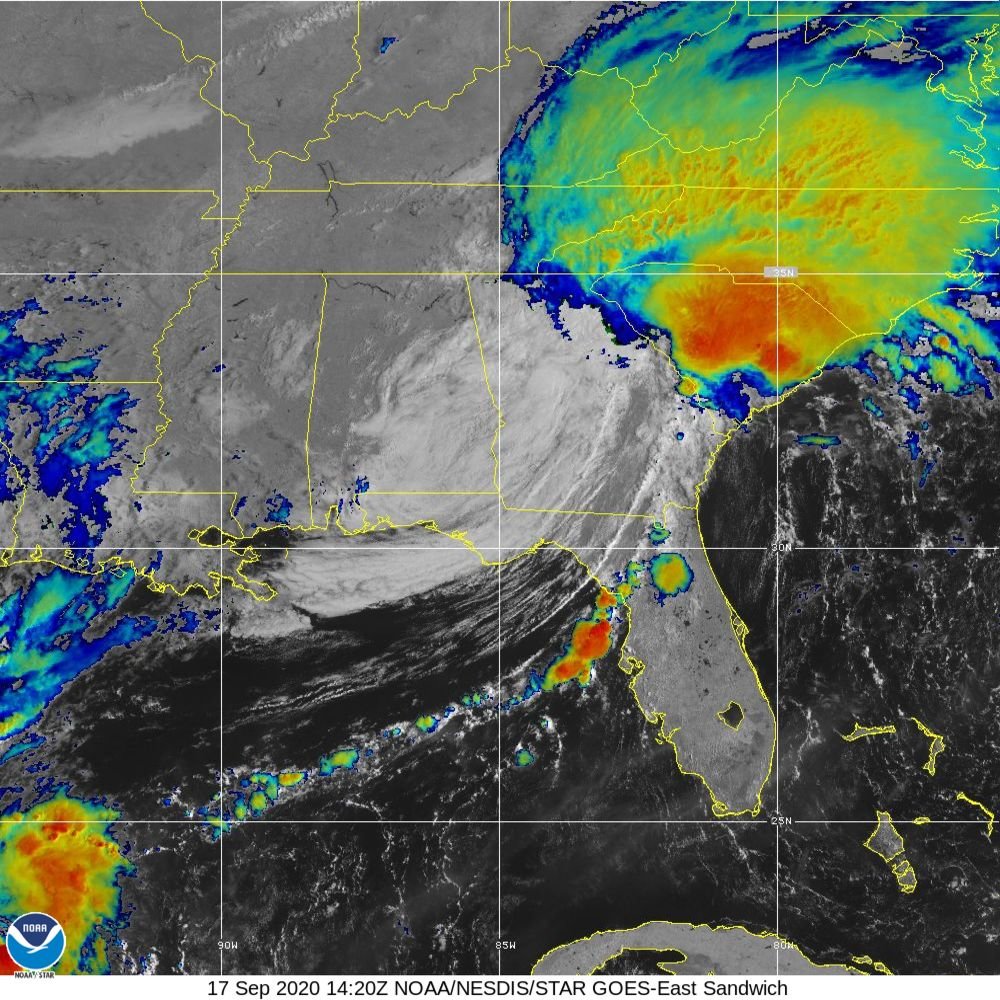
The first warning was issued between 8 and 8:30 a.m. as the remnants of Hurricane Sally, now a tropical depression, spread through the area.
FLASH FLOOD WARNING
The Sumter Item is hearing of reports of localized flooding on roadways. Do not drive through a road that has standing or moving water.
Sumter County and the surrounding area is under a flash flood watch from Thursday through Friday morning and a flash flood warning until 3:15 p.m. Thursday. Clarendon County is included in the warning.
Some locations that will experience flash flooding include Columbia, Sumter, Camden, Bishopville, Shaw Air Force Base, South Sumter, Elgin, Sumter County Airport, Mulberry, Millwood, Oakland, Elliott, Lee State Park, Goodale State Park, Lugoff, Woods Bay State Park, Turbeville, Mayesville and Lynchburg.
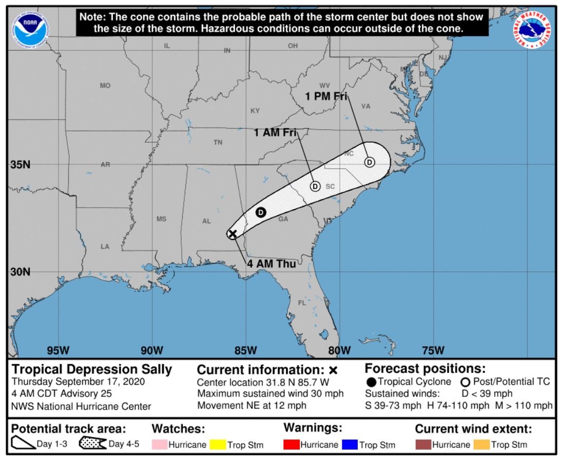
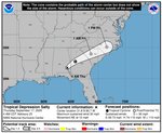
As the remnants of Hurricane Sally, which has been downgraded to a tropical depression as it moves inland from the Gulf Coast, the system is expected to spread rain across Georgia and South Carolina before it heads offshore of the Carolinas by Friday evening.
According to the National Weather Service, 4-7 inches of rain are expected across the region with “locally higher amounts in much of South Carolina and eastern Georgia.”
The NWS in Columbia predicts Sumter and Lee counties stand to take in 3-4 inches, while Columbia and Camden will receive 4-6 inches and Manning 2-3 inches.
The main areas of concern for flash flooding are along smaller streams, creeks and in urban areas.
Heavy rain in Sumter is expected Thursday and Thursday night, and forecasts say to be prepared for storms through Saturday afternoon.
TORNADO WATCH
Sumter, Clarendon and Lee counties as well as the surrounding Midlands and Upstate are under a tornado watch until 6 p.m. Thursday.
WHAT’S THE DIFFERENCE BETWEEN A WATCH AND A WARNING ISSUED BY THE NATIONAL WEATHER SERVICE?
Tornado Watch: Be Prepared. Tornadoes are possible in and near the watch area. Review and discuss your emergency plans and check supplies and your safe room. Be ready to act quickly if a warning is issued or you suspect a tornado is approaching. Watches are issued by the Storm Prediction Center for counties where tornadoes may occur. The watch area is typically large, covering numerous counties or even states.
Tornado Warning: Take Action. A tornado has been sighted or indicated by weather radar. There is imminent danger to life and property. Move to an interior room on the lowest floor of a sturdy building. Avoid windows. If in a mobile home, a vehicle or outdoors, move to the closest substantial shelter and protect yourself from flying debris. Warnings are issued by your local forecast office. Warnings typically encompass a much smaller area (around the size of a city or small county) that may be impacted by a tornado identified by a forecaster on radar or by a trained spotter/law enforcement who is watching the storm.