
Sumter outdoors columnist Dan Geddings: The Cowasee Basin


I have walked the piney woodlands and paddled through the cypress swamps. I have marveled at the giant timber and gazed across the rolling hills. I've run the rivers. I have climbed the bluffs, and I have walked in the paths. I know the solitude of this natural land. But there is much that I have not yet seen.
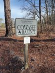
It is a land of beauty and wonder. A land of swamps and rivers, bluffs, high hills and uplands. It covers more than 315,000 acres in Sumter, Richland, Kershaw and Calhoun counties. It stretches north from the Rimini area on Lake Marion to Interstate 20 in Kershaw County. It includes a section of the Congaree River from Interstate 77 south to where it merges with the Wateree River.
Most of the Cowasee Basin focus area consists of bottomland hardwood forest within the Congaree, Wateree and upper Santee River floodplains. Approximately 32% of the basin consists of state and federal lands including Sparkleberry Swamp, Manchester State Forest, Poinsett State Park, Congaree National Park, Congaree Bluffs Heritage Preserve and Wateree Heritage Preserve.
The name COWASEE is an acronym for the COngaree, WAteree and SantEE river basins and is modeled after the coastal ACE Basin.
A task force was created in 2005 and is a unique partnership between various conservation organizations and interested landowners. Members of the task force include Congaree Land Trust, Ducks Unlimited, Friends of Congaree Swamp, USDA Resources Conservation Service, Richland County Conservation Commission, South Carolina Department of Natural Resources, Sumter County Soil and Water Conservation District, The Conservation Fund, The Nature Conservancy and the U.S. Fish and Wildlife Service. Landowners include Hugh Ryan, Roy Belser, Billy Cate, John Cely, Bob Perry, Buddy Baker, Angus Lafaye, Brook Moore, Hank Stallworth and Dick Watkins.
The Cowasee Basin is rich in wildlife habitat and cultural resources. There are outdoor recreational opportunities for hunters, fishermen, hikers, boaters and birdwatchers. The goal is to protect these valuable resources through land acquisition and conservation easements so future generations will continue to enjoy these opportunities.
Protected acreage includes 98,434 acres of public land and 43,837 acres of private land for a total of 142,271 acres conserved. Lands that still need to be protected include 164,411 acres. And there are currently 8,226 acres of prospective conservation easements.
The cultural value of these lands is immense. The eastern border of the basin is bounded by S.C. 261, which roughly follows the old Kings Highway. Soldiers from two wars traveled this old road. The Gamecock Thomas Sumter and Swamp Fox Francis Marion clashed with Cornwallis' troops here. Civil War skirmishes raged up and down the road in Potter's Raid. There are old churches and plantation homes along the road. On the Congaree, a battle at Fort Motte pitted Light Horse Harry Lee and Francis Marion against a British garrison. Those days led us here.
The "Wateree Passage" of the Palmetto Trail passes through this area. The High Hills of the Santee rise above the Sumter County side of the basin. Cook's Mountain pushes against the Wateree River on the Richland County side. Wedgefield, Statesburg and Boykin cling to existence on the eastern edge of the basin. Kingville and Fort Motte have been reclaimed by the bramble and bush along the Congaree. Lone Star on the Santee is only a ghost town now.
The Cowasee Basin is a work in progress. There are lands yet to be protected. Much of the land is unspoiled and has not changed much over time.
Many of us have lived here all our lives and have taken these things for granted. Some of you are from other places and are new to the area. If you can take the time, get out and explore the natural wonders at our doorstep. The Cowasee Basin is here for all of us.
Email Dan Geddings at cdgeddings@gmail.com.